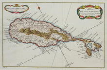
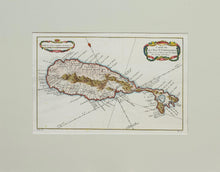
An antique map of the Leeward Island of St Kitts, published in 1758 in La Harpe's "Histoire Generale Des Voyages.." by Nicolas Bellin. Published in Paris. Old hand colours.
Jacques-Nicolas Bellin (1703 – 1772) was born in Paris. He was a French hydrographer, and over a 50-year career he produced a large number of maps of particular interest to the Ministère de la Marine. He was also a member of the Royal Society in London. He died at Versailles.
Mounted. Ready to frame.
Print size: 32.5cm x 21cm
Mount size: 47cm x 36.6cm


