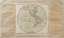
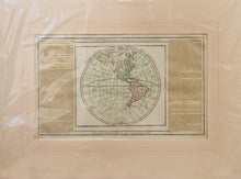
An antique map, in original colours, of a hemisphere of the globe showing the Americas. On either side of the hemisphere is a description in French of the continents. Published in 1766 by Desnos, Paris. A rare map by Louis Brion de la Tour (1743-1803) and Louis Charles Desnos (1725-1805). Brion was the Cartographer Royal to the King of France, his title being Ingenieur-Geographe du Roi. Desnos, also French, was Royal Globemaker to the King of Denmark, Christian VII. As a publisher he produced a substantial amount of work, often with Brion. Mounted. Ready to frame.
Print size: 49.5cm x 30.5cm
Mount size: 70.5cm x 52cm


