Mauritania Numidia and Africa - Antique Map 1856
  • Load image into Gallery viewer, Mauritania Numidia and Africa - Antique Map 1856
  • Load image into Gallery viewer, Mauritania Numidia and Africa - Antique Map 1856
  • Load image into Gallery viewer, Mauritania Numidia and Africa - Antique Map 1856

Mauritania, Numidia and Africa - Antique Map, 1856

Item #M350
Regular price
£28.00
Sale price
£28.00
Regular price
Sold out
Unit price
per 
Tax included.

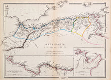
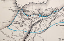
An antique map in original colours of the north coast of Africa. Engraved by GT Sherman, and published in New York, circa 1856. The map shows present day Morocco, Algeria, Tunisia and Libya. There are two inset panels showing the coast from Libya to Egypt, and a detail of the Gulf of Tunis. Originally published in Sheldon and Company's 'An Atlas of Classical Geography'. Scale of the main map is 100 miles to the inch. Mounted. Ready to frame.

Print size: 32cm x 23cm
Mount size: 42.5cm x 35cm