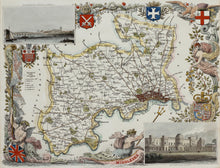
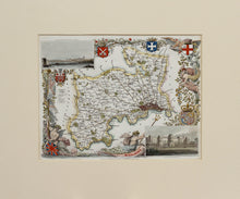
A beautifully hand coloured and ornate map of Middlesex, including the City of London, engraved by W Schmollinger for the publication 'Moule's English Counties', first published in 1836, this edition circa 1838. There are illustrations of Buckingham Palace and Westminster Bridge and Abbey. Thomas Moule (1784 – 1851) was an English antiquarian, expert on heraldry and a map maker. He is best known for his popular and highly decorative maps of counties of England - steel engraved, and first published separately between 1830 and 1832. Mounted. Ready to frame.
Print size: 26cm x 20cm
Mount size: 39.5cm x 33cm


