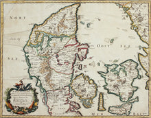
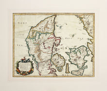
An antique map, in old colours, of North Jutland - the Kingdom of Denmark.
Nort-Iutlande - subdiuisee en ses quatre Dioeceses - Selande, Fuynee ou Fionie. Isles et Prouinces du Royaume de Danemarck. This map is by Sieur Nicolas Sanson D'Abbeville, geographer to the King of France. Sanson's maps were published from 1629, and his Europe maps from circa 1648. Nicolas Sanson (1600 – 1667) was arguably the pre eminent cartographer of his generation, termed by some the father of French cartography. He was born of an old Picardy family of Scottish descent at Abbeville, and was educated by the Jesuits at Amiens.
Repaired as seen in top left hand corner.
Mounted. Ready to frame.
Print size: 53.5cm x 41.5cm
Mount size: 72cm x 60.5cm


