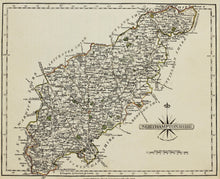
An antique map of the English county of Northamptonshire, engraved and published by John Cary of London, circa 1793. Cary served his apprenticeship as an engraver in London, before setting up his own business in the Strand in 1783. He soon gained a reputation for his maps and globes, his atlas The New and Correct English Atlas published in 1787, became a standard reference work in England. Mounted. Ready to frame.
Print size: 27cm x 22cm
Mount size: 40cm x 35cm


