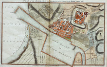
An antique map showing the harbour and fortifications of the French port of Boulogne at the beginning of the 19th century, drawn and engraved by J Russell, and published by J Stratford, Holborn, London, in 1804. Hand coloured. It's a military map, showing the positions of various gun emplacements, etc, and the defending French soldiers' camps.
Mounted. Ready to frame.
Print size: 36.5cm x 23cm
Mount size: 50cm x 36cm


