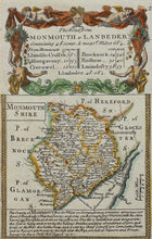
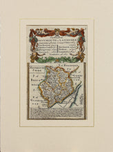
The Road from Monmouth to Lanbeder - Antique Map by Owen/Bowen circa 1720
  • Load image into Gallery viewer, The Road from Monmouth to Lanbeder - Antique Map by Owen/Bowen circa 1720
  • Load image into Gallery viewer, The Road from Monmouth to Lanbeder - Antique Map by Owen/Bowen circa 1720

The Road from Monmouth to Lanbeder - Antique Map by Owen/Bowen, circa 1720

Item #84515
Regular price
£40.00
Sale price
£40.00
Regular price
Sold out
Unit price
per 
Tax included.

An antique, hand coloured map entitled The Road from Monmouth to Lanbeder showing a map of Monmouthsire with distances between towns and general information about the county. Published in the atlas Britannia Depicta which was based on the earlier work of John Ogilby. Britannia Depicta was printed in 1720 by Emanuel Bowen and John Owen.
Mounted. Ready to frame.

Print size: 18.5cm x 12cm
Mount size: 30cm x 22.5cm