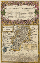
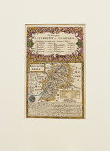
The Road from Salisbury to Campden - Antique Map by Owen/Bowen circa 1720
  • Load image into Gallery viewer, The Road from Salisbury to Campden - Antique Map by Owen/Bowen circa 1720
  • Load image into Gallery viewer, The Road from Salisbury to Campden - Antique Map by Owen/Bowen circa 1720

The Road from Salisbury to Campden - Antique Map by Owen/Bowen, circa 1720

Item #99791
Regular price
£68.00
Sale price
£68.00
Regular price
Sold out
Unit price
per 
Tax included.

An antique, hand coloured map of Gloucestershire, entitled the road from Salisbury to Campden, by John Owen and Emanuel Bowen. Published circa 1720. It appeared in a pocket road atlas entitled Britannia Depicta or Ogilby Improv'd. Mounted. Ready to frame.

Print size: 18.5cm x 12cm
Mount size: 30.5cm x 22.5cm