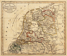
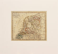
An antique map of what is now the present day Netherlands, in original colours. Engraved by J Russell and published circa 1815. The Netherlands regained independence from France in 1813. In the Anglo Dutch Treaty of 1814 the names "United Provinces of the Netherlands" and "United Netherlands" were used. In 1815, it was rejoined with the Austrian Netherlands and Liege (the "Southern provinces") to become the Kingdom of the Netherlands. Mounted. Ready to frame.
Print size: 23.5cm x 20cm
Mount size: 39.5cm x 37cm


