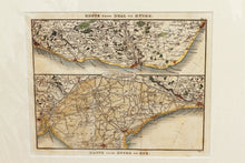
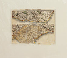
Two Route Maps of the Kent/Sussex Coast - Antique Map by Paterson circa 1824
  • Load image into Gallery viewer, Two Route Maps of the Kent/Sussex Coast - Antique Map by Paterson circa 1824
  • Load image into Gallery viewer, Two Route Maps of the Kent/Sussex Coast - Antique Map by Paterson circa 1824

Two Route Maps of the Kent/Sussex Coast - Antique Map by Paterson, circa 1824

Item #99821
Regular price
£48.00
Sale price
£48.00
Regular price
Sold out
Unit price
per 
Tax included.

An antique map with two panels of the coast of the English county of Sussex. The two maps are The Route from Deal to Hythe and The Route from Hythe to Rye, by Paterson, circa 1824. Hand coloured. Daniel Paterson (1739–1825) was a British Army officer and cartographer, known for his books of road maps. Mounted. Ready to frame.

Print size: 24.cm x 19.5cm
Mount size: 36.5cm x 33.5cm